Finger Lakes National Forest
Trails
Positioned along the ridges between Cayuga Lake and Seneca Lake, the Finger Lakes National Forest offers scenic beauty and unlimited recreational opportunities any season of the year. Whether you are a hiker, cross country skier, camper, fishing or hunting enthusiast, snowmobiler, horseback rider, mountain biker, or wildlife watcher, the Forest can provide the recreational experience you are seeking!
The Finger Lakes National Forest is a four-season recreation experience. The most popular season is autumn when the trees and pastures are ablaze with color. Autumn is also very popular for hunting in the woods and brush lands of the forest. Summer is popular for camping, hiking, horseback riding, bicycling, and fishing. Winter brings out cross country skiers, snowmobiles, and snowshoe enthusiasts. In spring, the Forest bursts forth from the grip of winter with emerging leaves on the trees, bird flyway activity, and numerous wildflowers that are visible along many of the Forest trails and pastures. The first fishing days are enjoyed by a lot of people. Mud season is usually short but intense. Going "off-road" and hiking on wet trails is not encouraged during this time.
Please use the trails below to guide your adventure through the Finger Lakes National Forest, or start by looking at this helpful map of the Finger Lakes National Forest and its trails. For more information visit the Forest Service website.
Backbone Trail
The Burnt Hill Trail is located on the southern end of the Forest, extending south from Picnic Area Road. It includes forests, shrub-lands and pastures and offers many beautiful vistas along the way. It is a primitive trail with a natural tread. It has gravel in wet areas and traverses through the fenced pastures.
Burnt Hill Trail
The Gorge Trail traverses through Hemlock and hardwood forests, following the gorge between Burnt Hill Road and Mark Smith Road. It is located on the southern portion of the Forest and is accessed from the Burnt Hill Road/Gorge Pond parking area or a parking area on Mark Smith Road, about ¾ miles north of State Highway 79.
Fossenvue Trail at Caywood Point
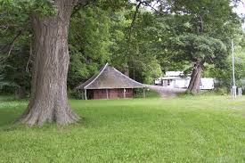
Caywood Point is the only part of the Finger Lakes National Forest bordering Seneca Lake. Fossenvue Trail is a gravel path, its lower portion fairly steep, which descends through forest to an open area beside the lake with a gravel beach and panoramic views. Its sole remaining cabin, the “Queen’s Castle” dedicated to co-founder Elizabeth Smith Miller, can be viewed but not entered.
Gorge Trail
The Gorge Trail traverses through Hemlock and hardwood forests, following the gorge between Burnt Hill Road and Mark Smith Road. It is located on the southern portion of the Forest and is accessed from the Burnt Hill Road/Gorge Pond parking area or a parking area on Mark Smith Road, about ¾ miles north of State Highway 79.
Interloken Trail
The Interloken Trail traverses the Forest from north to south and is a branch of the Finger Lakes Trail system. It passes through various terrain and vegetation. Southern portions are somewhat steeper and more forested; northern portions are flatter, more open, and travel through pasture lands.
No-Tan-Tahko Trail
The No-Tan-Takto Trail is nearly all open pastureland and traverses the Forest in a north/south direction between the Backbone Horse Campground and Parmenter Road. In some of the pastures there are outstanding vistas, including views of Seneca Lake to the west and Cayuga Lake to the east. The trail is relatively flat, with a primitive trail tread, gravel in wet portions, and traverses through fenced pastures.
Potomac Trail
The Potomac Trail travels through a variety of forest types and follows the edges of some of the numerous ponds in the area. This relatively flat trail has a primitive natural tread and traverses occasional wet areas. It is a nice loop on which to learn cross-country skiing and is also a popular game bird hunting area.
Ravine Trail
The Ravine Trail passes through hemlock and hardwood forests. As the trail loops around, it crosses a stream in 3 places with native rock step crossings. It is a primitive trail with a natural tread and is steep in some places. The Ravine Trail connects with the Interloken Trail at Burnt Hill Road.
Southslope Trail
The Southslope Trail is located at the south end of the Forest. The trail passes through hardwood and conifer stands and crosses a small stream. It is a primitive trail with plank boardwalk over wet areas. This trail intersects the Interloken Trail, and shares a portion of the Finger Lakes and North Country Trail Systems.


